
Verðlaun
2020 - The Excellence Award
Guðmundur Ragnar Einarsson, one of the owners of Pipp, woke up one beautiful day in March 2021 and was the proud owner of a volcano. Surreal experience to say the least, but seeing Guðmundur is a man with a beautiful mind he knew that this amazing turn of events could lead to something fantastic.
The website Volcano in Iceland was born a few days after the eruption in Fagradalsfjall on the Reykjanes Peninsula started. This website is operated by Guðmundur as a landowner but represents the entire group of landowners of “Hraunsland”, a vast, privately owned area in the Reykjanes Peninsula in Iceland. Smack down in the middle of “Hraunsland” you will find Fagradalsfjall mountain and Geldingadalir valleys, where a volcanic eruption started on the evening of March 19th 2021.
Guðmundur contacted social media guru Leon Hill who put together an impressive content team, which consists of Iceland’s brightest talents on social media. The aim of Volcano in Iceland is to produce marketing material for companies big and small, creating revenue for the landowners’ association of “Hraunsland” for future projects near the volcano eruption.
This website is also dedicated to mediate information about the eruption, how to get there, what to bring and first and foremost; to encourage respectful behavior on the way and close to the eruption. The natural forces are a breathtaking thing to watch up close and are not to be messed with.
About the volcanic area
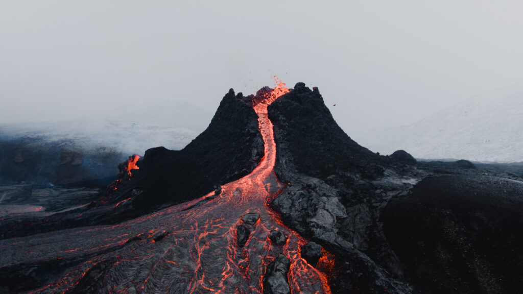
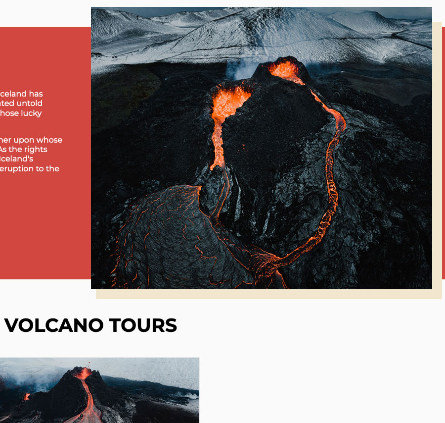
A volcanic eruption started in Geldingadalir valleys on the eve of March 19th 2021. This marked the first volcanic eruption on the Reykjanes Peninsula for 800 years. Molten lava soon spread out in Geldingadalir valleys and started running down to Meradalir valleys, more specifically on the 5th of April 2021.
Though we speak about valleys, since the Icelandic word “dalir” means valleys, neither Geldingadalir nor Meradalir are proper valleys. Both areas are more like a string of basins or shallow valleys.
The name Geldingadalir is a combination of two Icelandic words; „geldingur“ and “dalur”. The literal translation of the word “Geldingur” is eunuch, though in this case it means a castrated animal, more specifically sheep, a wether. The origin of the name Geldingadalir, the Wethers Valleys, is that farmers wanted to separate wethers from ewes and lambs because castrated sheep do not produce milk. The wethers were most likely kept in Geldingadalir during the summer, since the valleys are located on the mountains and the area is referred to as the highlands of the Reykjanes Peninsula.
The name Meradalir is easier on the tongue and simpler to explain. „Meri“ means mare, so it should not come as a shock to learn that mares, and in fact wethers as well, have roamed this area in olden days. The flocks of animals that wandered around those parts were however not big in numbers since the quality of the land were, and have always been, quite meager. The area is sparsely vegetated and farming has never been the main industry on the Reykjanes Peninsula. The number of livestock on the Peninsula have been consistently small and the best example of that is found in the registry for the farm “Hraun” on “Hraunsland” in the beginning of the 18th century. Three rams, four cows, eleven ewes, a few ewe lambs and some lambs. That was it.
This once bare area has now become one of the most popular attractions in Iceland and the challenging and harsh terrain swallowed by tons of molten lava. The eruption could go on for years, even decades, hopefully allowing the public and the scientific community to admire and study its glory for many years to come.
For media and corporate partnership inquiries please contact: hello@volcanoiniceland.com
All material on this website is protected by copyright. Reproduction of multiple copies of materials on this site, in whole or in part, for the purposes of commercial redistribution is prohibited except with written permission from Volcano in Iceland.
What to bring
The Reykjanes Peninsula is a true natural gem, a Geopark and the only place in the world where the Mid-Atlantic Ridge is visible above sea level. The landscape is somewhat reminiscent of the moon with its tuff mountains, hyaloclastite ridges, several series of craters, moss and lava stacks. The terrain is therefore challenging and important for hikers to Geldingadalir volcanic eruption to be well equipped for the hike.
Clothing
Hiking shoes
Soft and comfortable hiking socks
Spikes for hiking shoes if the temperature goes below 0°C
Wool or fleece underwear
Wool or fleece sweater
Rain and wind proof outerwear
Warm hat
Mittens
Leg warmers
In the backpack
A packed lunch for the whole day
Snacks, such as dried fruit, chocolate and nuts
Water bottle
Thermos with hot chocolate, tea and coffee
Walking sticks
Camera
Powerbank
Binoculars
First aid kit
Pain killers
Napkins
Headlamp
Plastic bag for waste
The most important thing to bring is however the right state of mind. Be respectful of nature, don’t litter and don’t do anything stupid or dangerous. The weather can change quite quickly so be prepared for everything and anything. Enjoy the moment, take in every minute of this unforgettable experience and smile.
How to get there
The hike up to the volcanic eruption in Geldingadalir starts from road 427, approximately ten minutes drive east of Grindavík. It’s forbidden to park along the road but there are designated parking areas about one kilometer east of the start of the hike. Hikers then have to walk from the parking area to the hiking trails so added time for the hike is around 40 minutes.
Another option is to pay a small fee for a bus driving from Grindavík to the hiking trails every half hour. The first bus leaves at 8 AM and the last one leaves the hiking trails at 10 PM.
Click here to see a map of bus stops in Grindavík. The bus stops are marked with orange and parking lots in Grindavík are marked with blue.
The hike up to the volcanic eruption in Geldingadalir is quite challenging, leading through lava fields, gravel and uneven ground. Some parts of the hike are steep and the elevation gain is approximately 200 meters.
There are two marked trails that lead up to the volcanic eruption. The lower trail is shorter, about four kilometers each way. That trail has one extremely steep slop with a rope to hold onto. For somewhat experienced hikers the return trip takes around two to three hours. For people that are not used to hiking the return trip should take somewhere between four and six hours.
Click here for a GPS track of the shorter route.
The upper trail is a little more than four kilometers with one very steep slope with a rope to hold onto. For somewhat experienced hikers the return trip takes around two to three hours. For people that are not used to hiking the return trip should take somewhere between four and six hours.
Click here for a GPS track of the longer route.
Click here for a map of both trails.
Click here to download a map with the trails for your mobile.
Beware that these trails can be closed or changed without much notice. Stay updated on hiking trails on Safe Travel’s website.

